I’ve had a love affair with the High Line Canal since I moved from Boulder to southeast Denver almost 30 years ago. Ever trying to find interesting places to run, this ribbon of green is the motherlode of trails. Like a little piece of heaven, it brings serenity to the city with its impressive breadth, massive trees, scenery and wildlife.
Meandering through the southwest, southeast and eastern sections of the Denver metro area, the Canal is one of the most treasured urban trails in the city. Spanning 71 miles, what was originally planned as an irrigation ditch that never quite reached its potential, it is now a beloved oasis that has been enjoyed by generations. The Canal and its enveloping 100 foot corridor comprise 860 acres and it crosses 98 streets in its journey to the plains.
It is estimated that over 500,000 people use the trail during the year — I am definitely not alone in being passionate about this belt of open space.
The Canal was originally developed in 1883 to carry ¾ of a billion gallons of water per day to cultivate 50,000 acres of crops. However, it fell short of its goal due to competing water rights on other area irrigation ditches. Furthermore, the design of the Canal proved inefficient in its delivery of water. Denver Water, which took over the operation of the Canal in 1924, estimates 60-80% of the water flow is lost to seepage and evaporation. Yet, up until 2008, the Rocky Mountain Arsenal National Wildlife Refuge took on water from the High Line Canal.
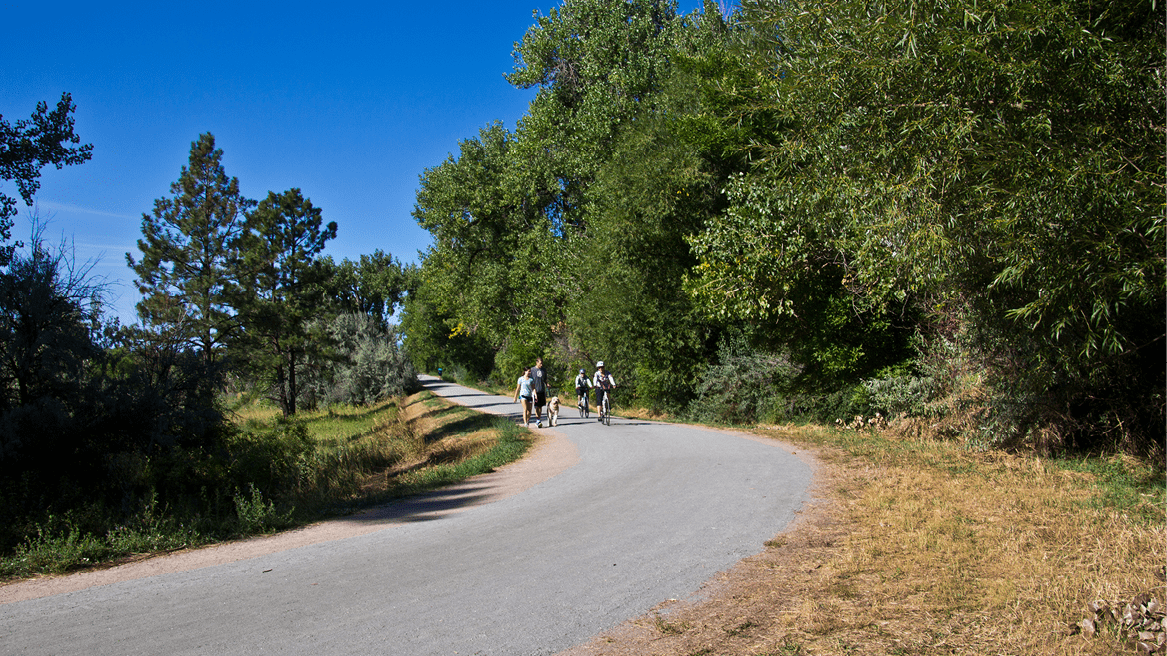
From its origin at the mouth of Waterton Canyon to its culmination in Adams County, the Canal bends through open space, neighborhoods and parks, providing incredible vistas and opportunities to see the Denver metro area in a whole new way. No longer a water delivery vessel, the Canal has reinvented itself and is now an invaluable recreation resource. From the dirt outlays in Douglas and Arapahoe counties to the asphalt and concrete surfaces in Denver and Aurora, it is a resource revered by many. Homeowners adjacent to the Canal enjoy higher property values and coveted access to immediate open space and enjoyment.
Although Denver Water serves as the manager of the Canal, its custodians are the jurisdictions through which the Canal flows. Douglas County, Highlands Ranch Metropolitan District, South Suburban Parks and Recreation, Greenwood Village Parks and Trails, Cherry Hills Parks and Trails, Denver Parks and Recreation and Aurora Parks and Recreation all provide maintenance operations along the trail to keep it viable and healthy.
Huge cottonwoods line the path of the Canal, many of which are over 100 years old. These huge sentries provide soothing shade and aesthetic pleasure for people enjoying the trail. It is estimated there are over 23,500 trees along the trail, making for an amazing urban canopy that provides much needed cover in the city. This tree inventory was funded in 2016 by the High Line Canal Working Group. Additionally, there are heavy stands of shrubs, Russian olive and newly planted trees to replace aged trees that have been felled for safety reasons.
According to the High Line Canal Conservancy, which was created in 2014 to preserve, protect and enhance the Canal and provide public oversight and input into its management, there are 199 species of birds, 28 mammals and 15 species of reptiles living along the Canal at any given time. Deer, elk, and even mountain lions and bears use the corridor and sometimes venture into the city.
Water now runs intermittently in the Canal from April to October. A diversion structure, located on South Platte River two miles up Waterton Canyon, controls the amount of water released into the Canal. In the spring of 2015, this 130+ old device was damaged during high runoff. After $1 million in repairs by Denver Water, water was once again released into the Canal in May of this year and later shut down in June. During heavy rain storms, the Canal will fill and run rapidly for a few days before dwindling to a trickle. Some sections of the Canal have gates that allow greater or lesser flow depending on the amount of water. According to Suzanna Fry Jones, director of marketing and community outreach for the HLCC, the future of water in the Canal from the South Platte River is “uncertain.”
“We have a rare opportunity to create a green infrastructure with multi-layered benefits, including providing water quality and a source of water to keep the ecological corridor thriving,” she explained. “Two stormwater demonstration projects are in the design phase, one in Denver at Eisenhower Park and another in Greenwood Village. Both are expected to start construction later this year.”
These projects will help maintain and manage water in the Canal more effectively at various times during the year which, in turn, will help irrigate the vegetation along the canal more efficiently. Despite suggestions to line the canal to alleviate seepage and evaporation, the approach now is to create other water sources, most notably these types of reservoirs, to assure the Canal remains green.
Currently, Denver Water and its seven partners, along with the HLCC, will be developing a 20-year master plan to better manage and guarantee the populace’s continued enjoyment of the Canal. The City of Denver Department of Public Works is devising a plan that will correct the awkward linkage of the Canal between Hampden Avenue and the Wellshire Golf Course to Eisenhower Park on Colorado Boulevard. Right now, the path ends at Hampden (near South Monroe Street) and picks up again at Eisenhower Park at Colorado Blvd., south of Dartmouth. The Canal itself goes through Wellshire Golf Course with no associated trail until resuming at Eisenhower Park.
The design includes an underpass at Hampden that will connect to the Wellshire Golf Course. At that point, a newly constructed 10 foot wide path will run parallel to Hampden before turning north on Colorado Boulevard. Another underpass will be built under Colorado, integrating the path with Magna Carta Park and the existing Canal trail by Eisenhower Park.
Furthermore, another underpass is in the hopper where the East Branch of the Canal crosses I-70 near Tower Road.
These projects tie into the Conservancy’s goal of “thinking big” for the Canal’s future and how the public envision’s the resource in decades to come.
“We will be leading the second phase of planning, which will take a deeper look at all 71 miles — physical enhancements, landscape design guidelines and signage, and wayfinding,” said Fry Jones. “In addition, the Conservancy is actively engaged in current infrastructure improvements led by various jurisdictions, as well as programming efforts, which include a volunteer program, walking tours and youth engagement.
“The Canal faces many threats: from the population growth and development pressure to unsafe crossings and neglect. We must plan needed trail amenities for the inevitable increase in users, and work with the jurisdictions and developers to protect the natural setting so loved by Canal users. Some sections along the Canal have been filled in and others have been sold off. We must work with Denver Water to ensure the Canal’s entire 71-mile stretch is protected as public open space forever.”
There are many ways to stay involved and engaged with the High Line Canal. Check out the following HLCC’s efforts:
- Be a High Line Hero, joinhighinecanal.org
- The Canal newsletter
- Social media channels (Facebook, Twitter, Instagram)
- Visit the HLCC’s website to learn more: highlinecanal.org
- Check the calendar of events: highlinecanal.org/calendar