Cam the Ram may have its footing in Fort Collins as CSU’s beloved mascot but Waterton Canyon in Denver’s foothills hosts the real deal.
When it comes to viewing opportunities for bighorn sheep, Colorado’s state animal, you don’t have to look any further than the southwest metro area to see these magnificent creatures.
It had been over two decades since I’d last been to Waterton Canyon. Not two months or two years, two decades. I’m embarrassed to admit this fact but I guess life and driving kids to various practices and even a broken mountain bike got in the way of revisiting this outdoor treasure trove that has something for everyone.
The COVID-19 pandemic didn’t help matters either when the Canyon was closed to the public in mid-March. Thankfully, the Denver Water reopened this recreational paradise earlier this month and outdoor enthusiasts can once enjoy hiking, biking, fishing and viewing wildlife in this majestic corridor.
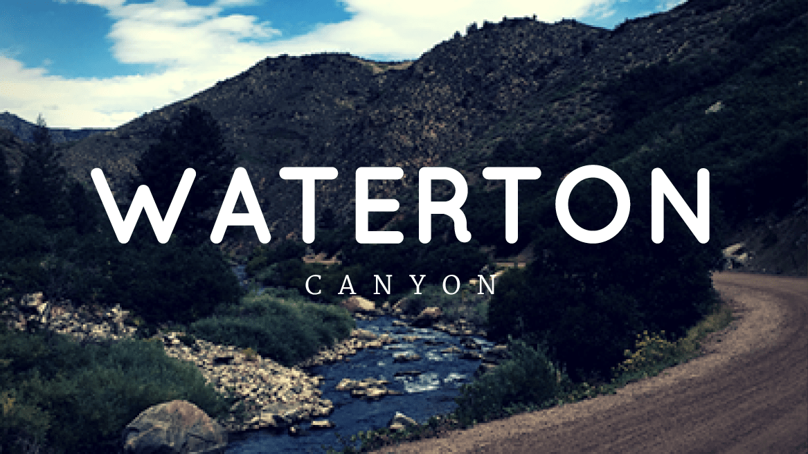
Recently, I ventured out to Waterton, located in the foothills southwest of C-470 and Chatfield State Park, and I wasn’t disappointed.
During my days working for the Division of Wildlife (now the Colorado Parks and Wildlife) as a public information officer, I would get up to the Canyon to help with electroshocking fish — a scientific survey method used to sample fish populations and determine density — or assist with wayward wildlife situations involving bears and mountain lions. I would marvel at this sanctuary that features over 40 varieties of birds, exceptional fishing and inspiring views.
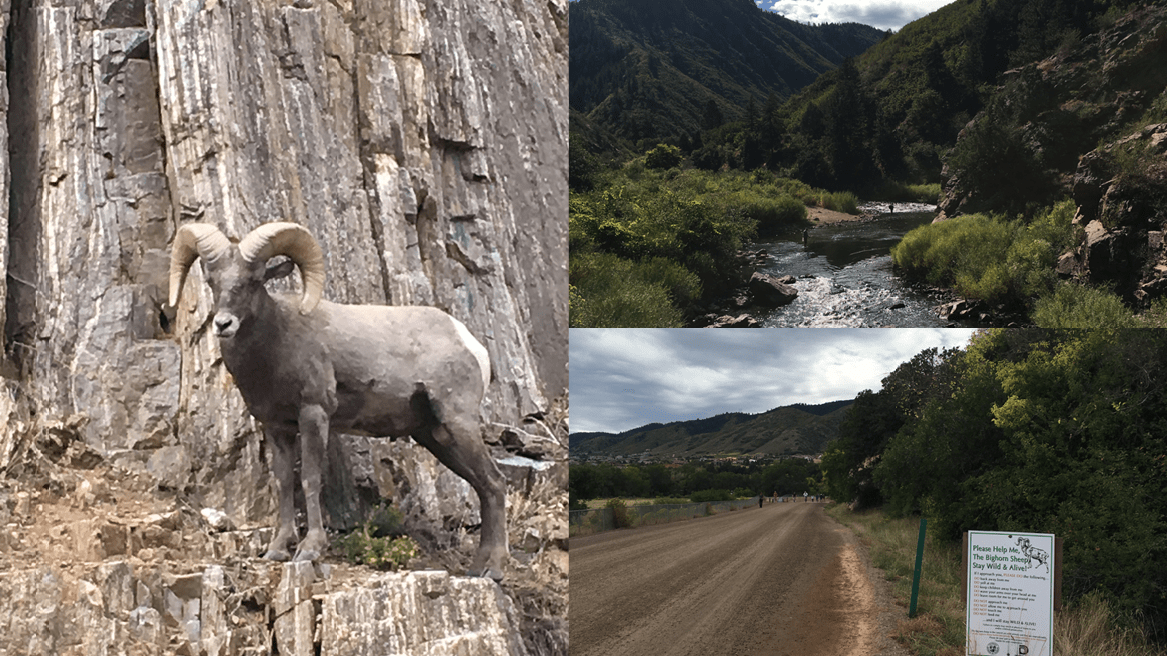
On my recent visit, I was three miles up the Canyon at the Marston Diversion Dam when I was greeted by a bighorn sheep on the road. The 1/2 curl ram was lazily munching on vegetation and barely noticed (or cared about) my presence. After a few moments, he lumbered down the edge towards the river where he joined two other massive rams, one chewing on some tree branch leaves and the other contently standing in the water.
Just another routine day in the Denver foothills up close and personal with the pride of Colorado.
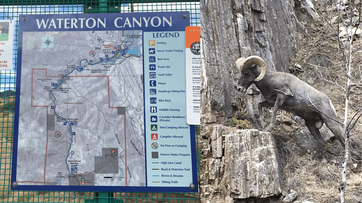
Managed by Denver Water in partnership with the U.S. Forest Service, Waterton is unique not only in enabling people to get great wildlife viewing opportunities but also providing outstanding fishing, hiking and horseback riding. Unlike trails in Denver metro counties and on USFS land, the canyon offers a wide dirt road that serves as the “path” and Denver Water trucks are the only vehicles allowed on the road. For the most part, you’ll just find hikers, cyclists and horseback riders enjoying this 6.7 mile stretch of paradise.
And, sometime it includes “sharing the road” with Colorado’s wildlife.
Please be aware that dogs are not allowed in Waterton due to its proximity to wildlife habitat. This is strictly enforced and there are no exceptions.
The dirt road is perfect for beginning hikers and runners seeking a quick refuge from the city. It’s also very popular among cyclists as the road is well maintained (no ruts) and offers a very easy grade up to the Strontia Springs Dam. At a slow, steady pace, it takes less than an hour to reach the dam.
Above the dam, the road turns into the heart of the Colorado Trail, a 486 mile passageway that winds its way through the Colorado Rockies. Covering eight mountain ranges, six national forests and six wilderness areas, it ranges in elevation from 5,500 feet from its meager beginnings in Denver at the mouth of Waterton Canyon to 13,271 feet in the San Juan Mountains. The trail ends just north of Durango. At a leisurely pace, it takes the average hiker 4-6 weeks to complete the trek.
In addition to the Colorado Trail, there are other trails above Strontia Springs. Steven Gulch trail dovetails into Indian Creek Trail which will take you into Roxborough State Park. Indian Creek Trail also intersects with the Power Line Trail which heads north and parallels the South Platte River, albeit from a 1-3 mile distance depending on where you are on the trail.
Regardless of the trail you’re on, the bighorn sheep in Waterton are a huge draw for many of the outdoor enthusiasts. Considered an indigenous species to the canyon, the bighorn sheep herd is flourishing. Now with their numbers closing in on 100, there are a handful limited hunting licenses issued for the area. This comes after decades of re-establishing the population following a huge die-off in the 1980s. As a result, the management of the herd has been carefully monitered by officials from the Colorado Parks and Wildlife.
People are warned never to approach or try to touch the bighorn sheep. It’s illegal to harass, bother or chase them, and always give wildlife the right-of-way. They are wild animals and can be unpredictable. Never feed wildlife.
The area is not only inhabited by bighorn sheep. You’ll find black bears, mule deer, moose and probably more rattlesnakes than you care to encounter. Birds soar overhead and you can catch black crowned night herons in the river, silently waiting for their next snack. The picnic areas and shelters are aptly named for the diversity of Colorado critters: Mule Deer, Great Blue Heron, Black Bear, Mountain Lion, Rattlesnake and Bighorn Sheep Rest Areas. These areas are outfitted with restrooms and even a bike rack (Bighorn Sheep Rest Area).
Camping and fires are allowed above Strontia Springs but always check the fire danger level before starting a campfire.
To get there: Take C-470 to South Wadsworth Blvd. Continue south on Wadsworth past Chatfield State Park. Turn left on Waterton Rd. and take the first left into the parking lot. This is a sizable lot and there is a convenient crosswalk that takes you to the other side. That path will connect you to the road to Waterton Canyon. The canyon is open daily, 30 minutes before sunrise and after sunset.
Don’t forget Waterton Canyon also serves as the starting point for the Highline Canal, a 71 mile trail that winds through the Denver metro area.
(Editor’s note: This blog was originally published in September of 2017. It has been edited and updated to reflect current information).